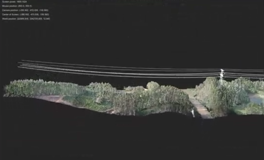
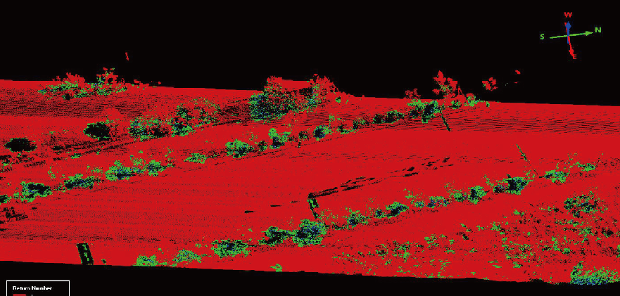
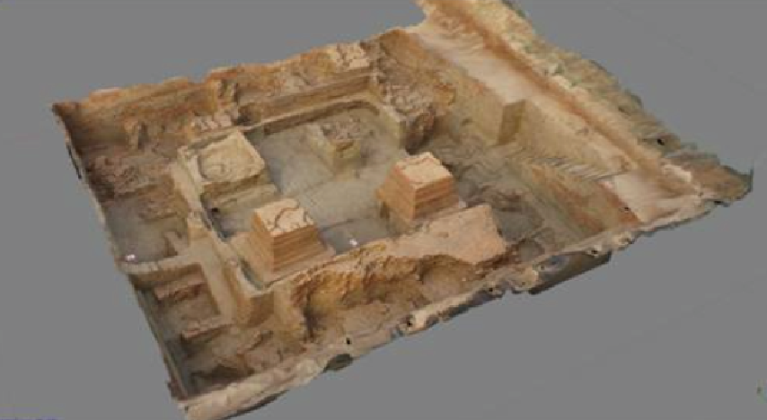
Radar Mapping
Using the high efficiency and high precision of UAV LIDAR mapping, we can investigate resources such as highways, railroads, bridges, water conservancy, land, forests, grasslands, mines, etc., monitor geological disasters, and carry out large scale and high efficiency 3D digital reconstruction of buildings, cultural relics, cities, sites, etc.
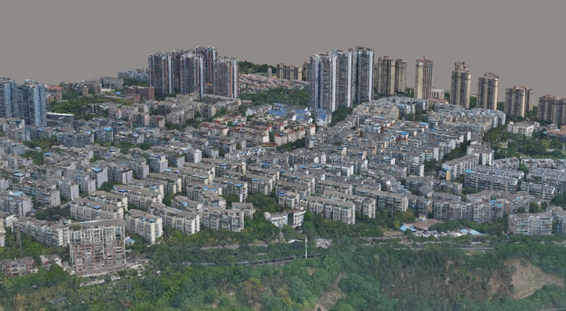
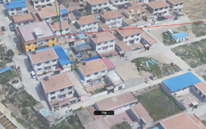
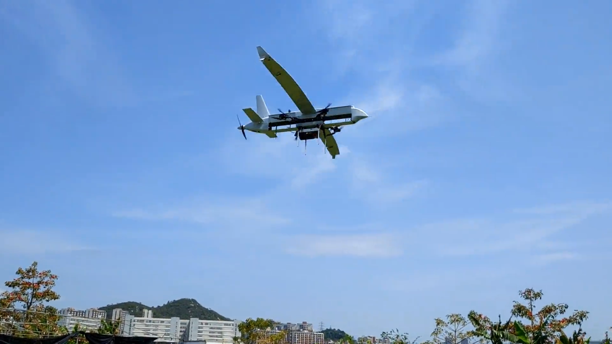
Tilt photography
The drone can carry a 120 million pixel tilt camera and can obtain 40 square kilometers of data in a single takeoff and landing, which can be used for urban 3D mapping, cultural heritage modeling, and urban 3D real-world construction.
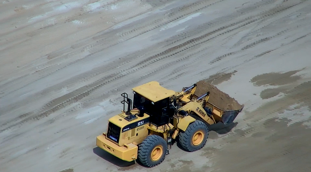
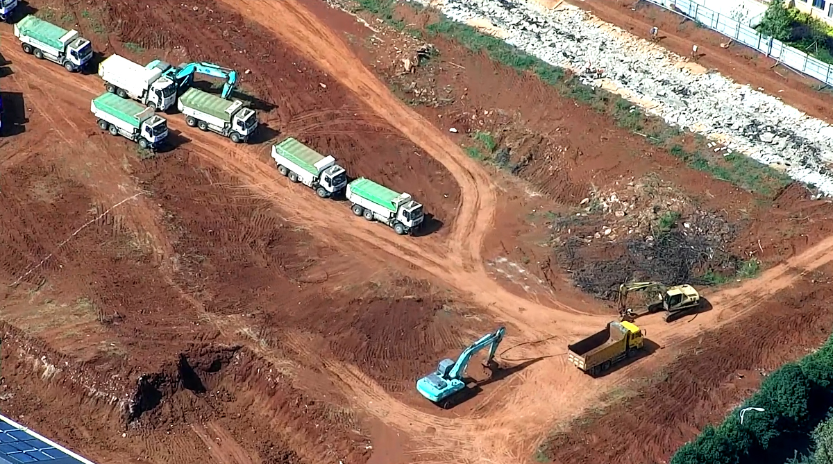
Resource Extraction
Illegal mineral mining monitoring; illegal excavation of sand and gravel, soil extraction inspection; illegal piling of waste; timely detection and disposal of illegal construction projects and buildings.
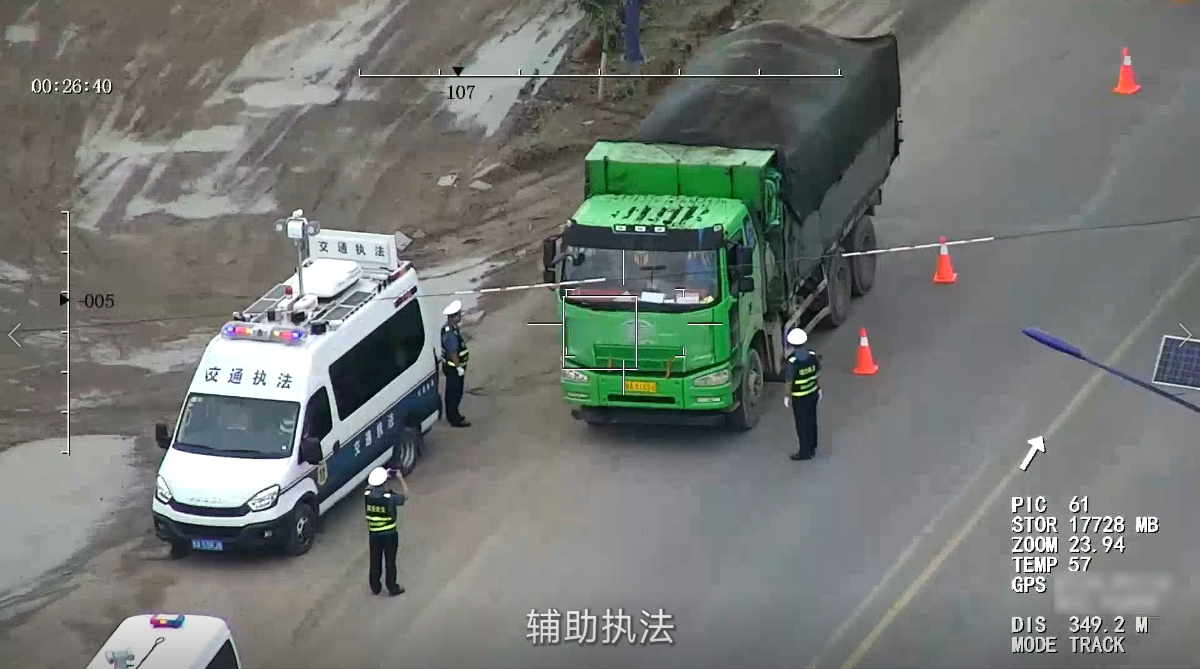
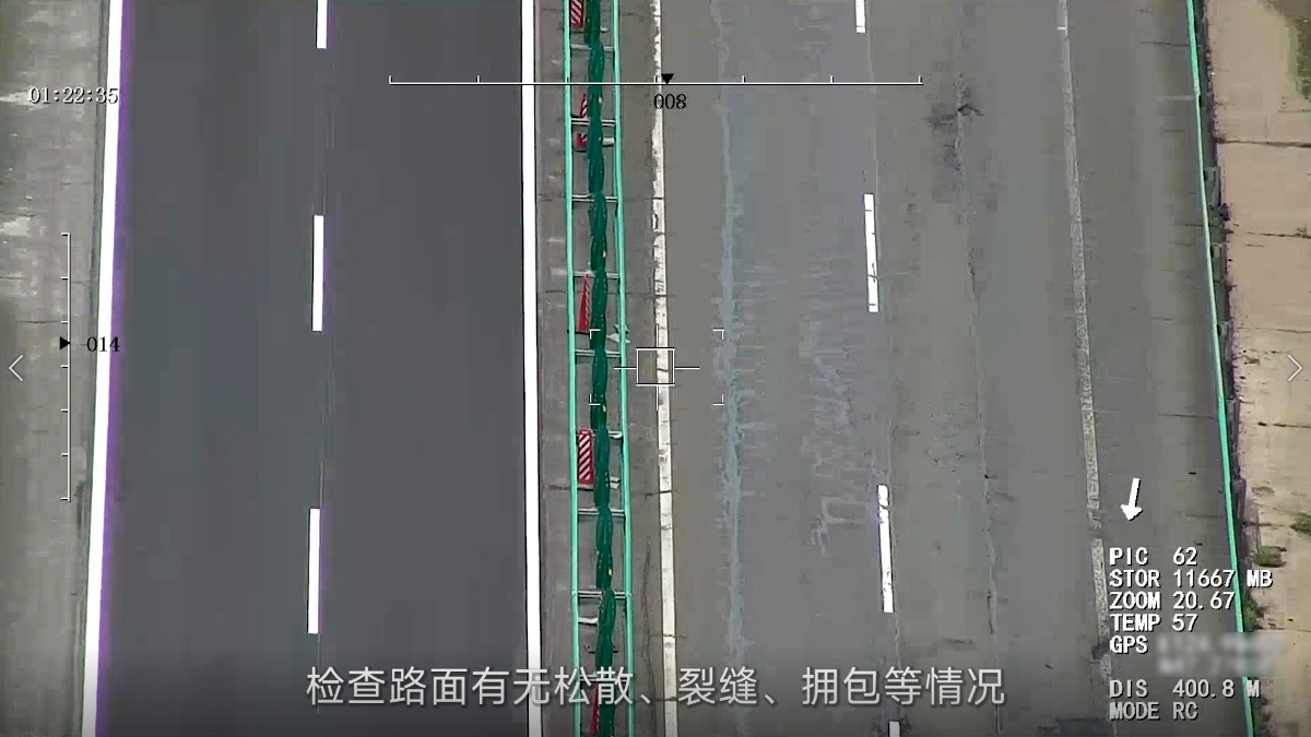
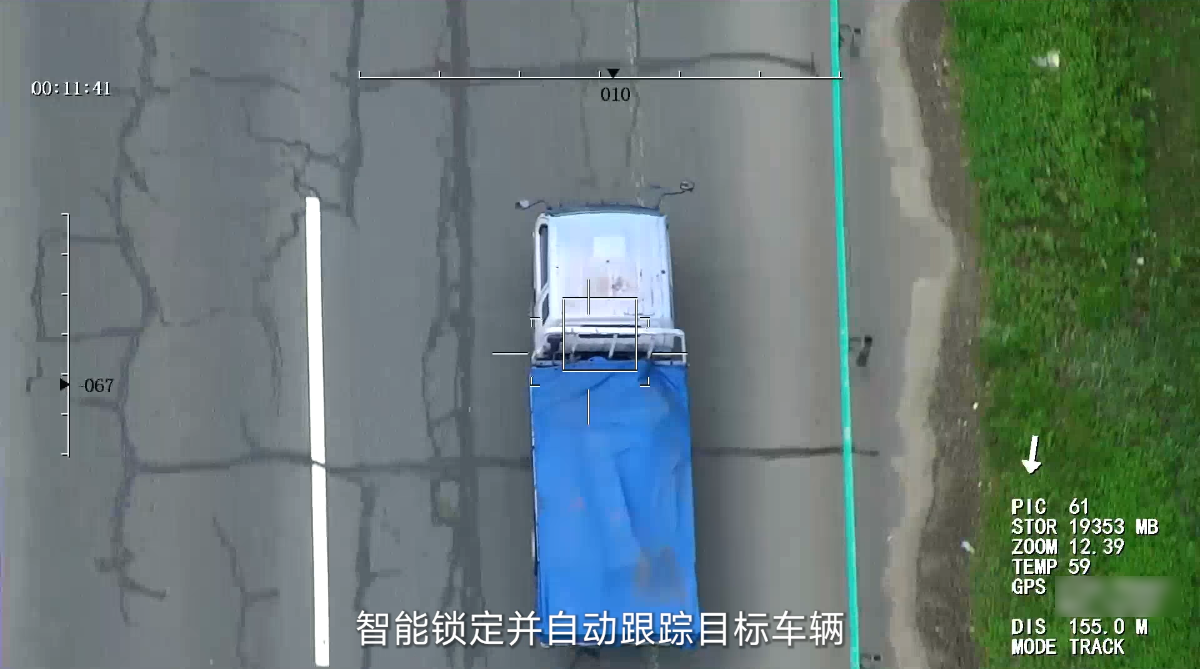
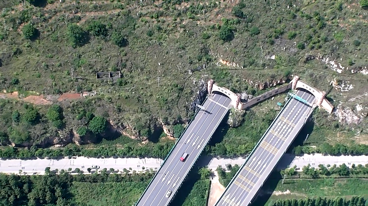
Highway inspection
Check whether the road surface is loose, cracks, congestion package; inspect road illegal construction, occupying road and other acts; timely discovery of encroachment, damage to roads and ancillary facilities; intelligent locking and tracking of target vehicles, air-assisted law enforcement; inspection of highway substrate, slopes, side ditches, to exclude slump, landslide, mudslide potential problems.